
Atlanta, GA (January 10, 2017) – The Georgia Geospatial Information Office (GIO) secured a grant from the U.S. Geological Survey (USGS) to help Georgia acquire highly accurate digital elevation data. The effort brought together State and Federal partners to maximize the data collected, which will cover nearly a third of the state. The grant was facilitated by the GIO, in partnership with the Georgia Department of Natural Resources, the Georgia Environmental Protection Division (EPD) and the U.S. Department of Agriculture’s Natural Resources Conservation Service (NRCS).
Highly-accurate digital elevation data, otherwise known as LiDAR, can be used extensively by local and state government to provide critical services to the citizens of Georgia. The EPD State Floodplain 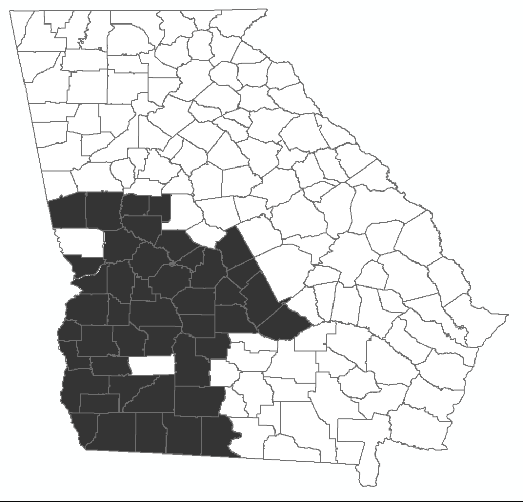 Manager, Haydn Blaize, noted that access to LiDAR data will allow for more precise definition of flood-prone areas and has substantial implications for improving public safety and reducing the cost of flood insurance.
“It makes a big difference,” said Blaize, “because a one foot difference in elevation could determine whether you are in a floodplain, or not.” The intergovernmental coordination and successful application of the USGS grant is one example of how the GIO can enhance the quality of services provided by local, state and regional governments.
“All levels of government across Georgia are eager to achieve economies of scale to save taxpayer dollars, and they can realize them by working more collaboratively and across political boundaries,” said Geospatial Information Officer Susan Miller. “After all, things like floods, wildfires and 911 calls do not stop at city or county lines, and neither should intergovernmental communication and cooperation. The common language of geography helps everyone to speak the same language and manage essential data.”
Miller noted that the willingness of EPD and NRCS to pool their data collection resources will enable this data collection to cover 44 Georgia counties, and exemplifies better orchestration of the development and management of critical mapping data throughout all levels of government.
###
About the Geospatial Information Office
The Georgia Geospatial Information Office (GIO) was established in 2015 through an innovative initiative by the Georgia Association of Regional Commissions in conjunction with a variety of statewide partners. The Georgia Department of Community Affairs (DCA) provides office space and administrative support for the GIO. The mission of the GIO is to coordinate and partner with local governments, State and Federal agencies to ensure the quality and availability of geospatial data to support statewide initiatives in community and economic development, transportation planning, emergency preparedness and environmental protection.
About the Georgia Department of Community Affairs
The Georgia Department of Community Affairs (DCA) partners with communities to create a climate of success for Georgia’s families and businesses through community and economic development, local government assistance, and safe and affordable housing. Using state and federal resources, DCA helps communities spur private job creation, implement planning, develop downtowns, generate affordable housing solutions, and promote volunteerism. DCA also helps qualified low- and moderate-income Georgians buy homes, rent housing, and prevent foreclosure and homelessness. For more information, visit www.dca.ga.gov.
CONTACT:
Susan Miller, State Geospatial Information Officer
(o) 404-599-0631
susan.miller@gio.ga.gov
Counties that will aquire LiDAR through a collaborative partnership between EPD, NRCS and the Georgia GIO.